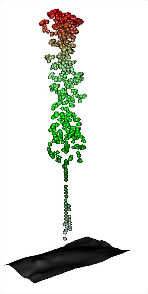
Lidar stands for Light Detection And Ranging. Without getting into anything too technical, it basically uses pulses of light in the form of lasers to determine the distance to something. This technology has been used a lot to perform remote surveys of large areas to determine elevations and slopes of a landscape. Researchers from Forestry Tasmania have adapted the technology to measure the height of trees and to some degree the amount of foliage that tree has.
Suffice it to say that it is pretty awesome. Especially when you start seeing images of more than 1 plant at a time, you can tell very quickly that this technology will be able to measure a forest's vegetative cover to some extent. Forest managers are already drooling over the prospects.
Check out more details at the ArcWatch article here.


No comments:
Post a Comment